
THE NEXT GENERATION TOOL FOR TIDAL ENERGY ASSESSMENT
A unique decision support system
for one area of benefit:
Marine Renewable Energy
Service description
TidEA is the first free and worldwide tool intended for general public and the relevant stakeholders of the maritime and the marine renewable energy sector.
Since 5 years, NOVELTIS has performed high resolution tidal atlases for the space agency and maritime industry. These atlases use
the best satellite data and in-situ observations procured by the Copernicus Marine Service in order to provide tidal currents and elevation all over the world:
- GLOBAL OCEAN ALONG-TRACK L3 SEA SURFACE HEIGHTS REPROCESSED (1993-ONGOING)
(SEALEVEL_GLO_PHY_L3_REP_OBSERVATIONS_008_062)
- GLOBAL OCEAN- IN-SITU NEAR-REAL-TIME OBSERVATIONS
(INSITU_GLO_NRT_OBSERVATIONS_013_030)
These data, which permit us to validate our tidal models and to produce the best worldwide tidal atlases, allow you, thanks to TidEA, to identify the best suitable zones for Marine Renewable Energies.
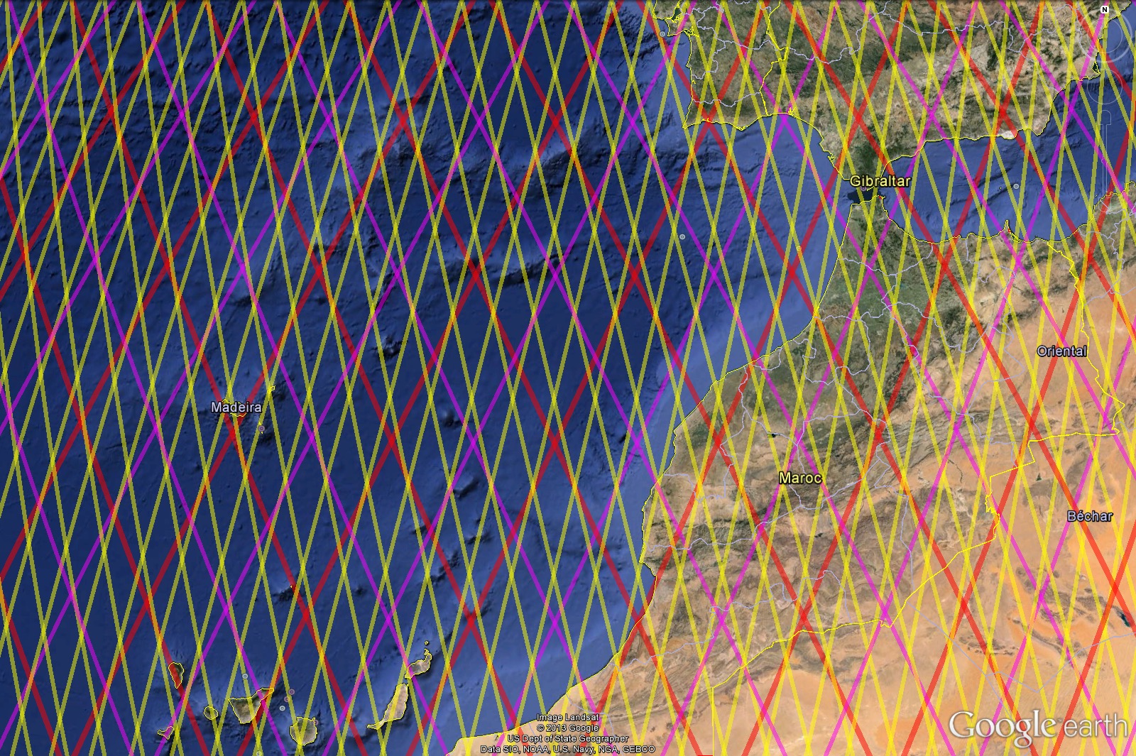
Altimetry data from 3 different satellites (Jason-1,
Jason-2, Saral Altika) used to validate our tidal model
Tide Gauge database
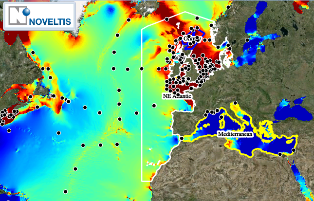
Valuable insights for resource assessment and site selection
Satellite and in-situ data provided by the Copernicus Marine Service have greatly expanded opportunities to make tidal atlases accurate.
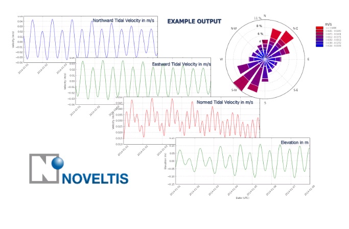
TidEA is processing these tidal atlases to provide you with the right indicators for a first level of tidal energy assessment :
b) Percentage of time where the current speed is higher than different thresholds (1.5 m/s, 3 m/s);
c) Average Power Density.
These indicators will be available only in the areas where the bathymetry is lower than 100 meters (Coastal areas).
Through TidEA, you will be able to download maps, reports and statistics in a couple of seconds.
Illustrations
With TidEA, you will have a free access to tidal energy indicators: maximum velocity, power density etc...
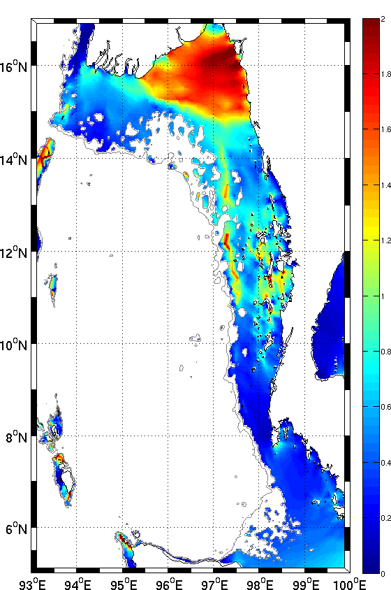
Map of maximum current speed (m/s) - Bengal
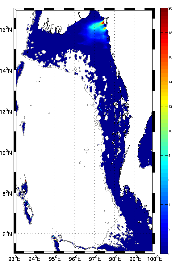
Map of percentage of time where the current speed is higher than some thresholds - Bengal
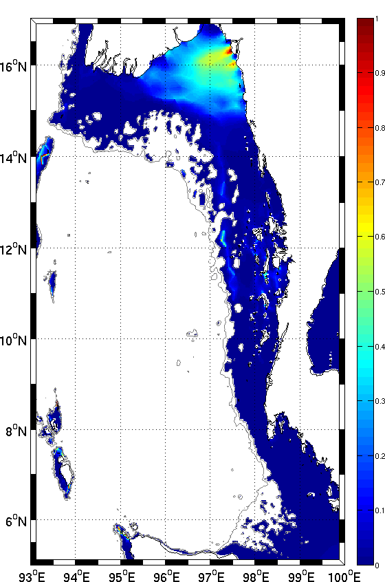
Map of Power Density (kW/m²) to define the tidal energy potential of your site - Bengal
FRANCE (HQ)
153, rue du Lac
F-31670 Labège
Tel: +33 (0)5 62 88 11 11
Fax: +33 (0)5 62 88 11 12